 Guide")
")

")
")
")
")
")
")
")


 Currency Exchange, ATMs & Banks")
")

 Departures")
")
The layout and structure of the LAS Airport terminals can be understood with the help of their map. The Las Vegas Airport map navigates them with directions to different areas and locations at Terminal 1 and Terminal 3. Moreover, the map points a pin at the distinct levels of each terminal of this airport, making it easy for travelers to find their desired location. Also, it becomes a helpful tool in reaching on time for doing pre- and post-flight procedures.

Las Vegas International Airport Terminal Map
The map of Harry Reid Airport terminals gives an overview of the 2 main complexes. It covers the entire structure of Terminals 1 and 3. From ticketing centers and luggage collection points to boarding gates and LAS parking lots, the tool is indicative of many areas.
Map of LAS Airport Terminal 1
To locate different zones, check-in counters, eateries, or lounges at Harry Reid Airport, the map can be used.

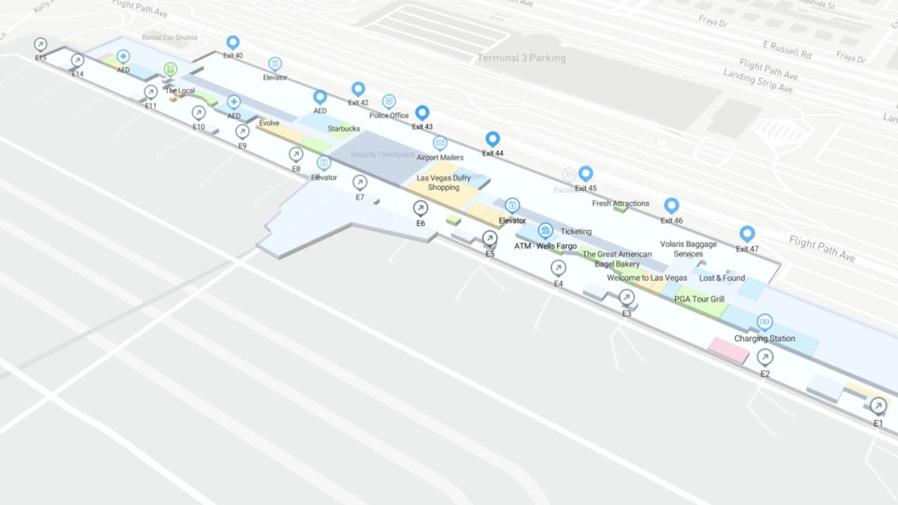
Terminal 3 Map at Harry Reid International Airport
The Harry Reid Airport map for Terminal 3 shows all 4 levels. It highlights the departure and arrival areas at each level while outlining the other important locations like the Mezzanine, parking spots, etc.
In short, Harry Reid International Airport provides a map to fliers. It can be a great tool, especially for a first-time flier and visitor. It helps identify the principal areas within the buildings. Also, this map enables travelers to find their path to these areas in the shortest time possible.
Frequently Asked Questions (FAQs)
The map of Harry Reid Airport shows two terminals, 1 and 3.
Yes, this map shows the food outlets at LAS terminals.
The Harry Reid Airport map highlights the boarding gates along with the respective airlines. Thus, one can use the tool to find the specific gate.
Using simple directions, passengers can walk between Terminals 3 and 1. They can use the Harry Reid Airport terminal map to find these directions.
Yes, the Las Vegas Airport shops are displayed on the map.